 Joy DiFranza
Portfolio
Where Data and Technology Meet My Passion for Maps: Showcasing My GIS Projects and Web Applications
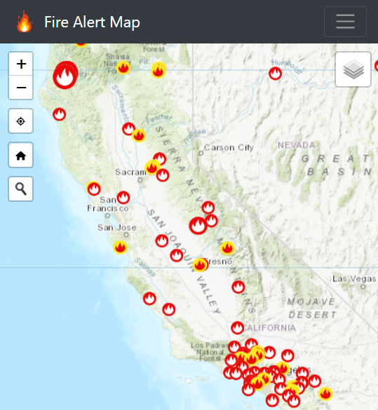
firealertmap.com
A map showing active wildfire locations, red flag warnings, fire weather watch, severe fire danger index overlay and jurisdictional boundaries.
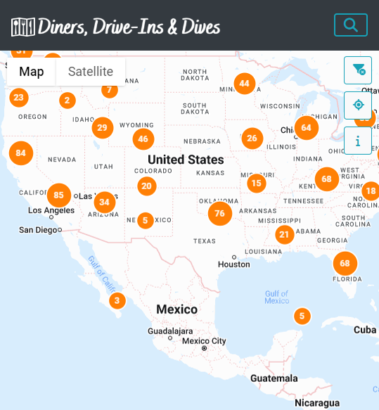
dddfanmap.com
A map showing restaurant locations from Guy Fieri's Diners, Drive-Ins and Dives Food Network television series.
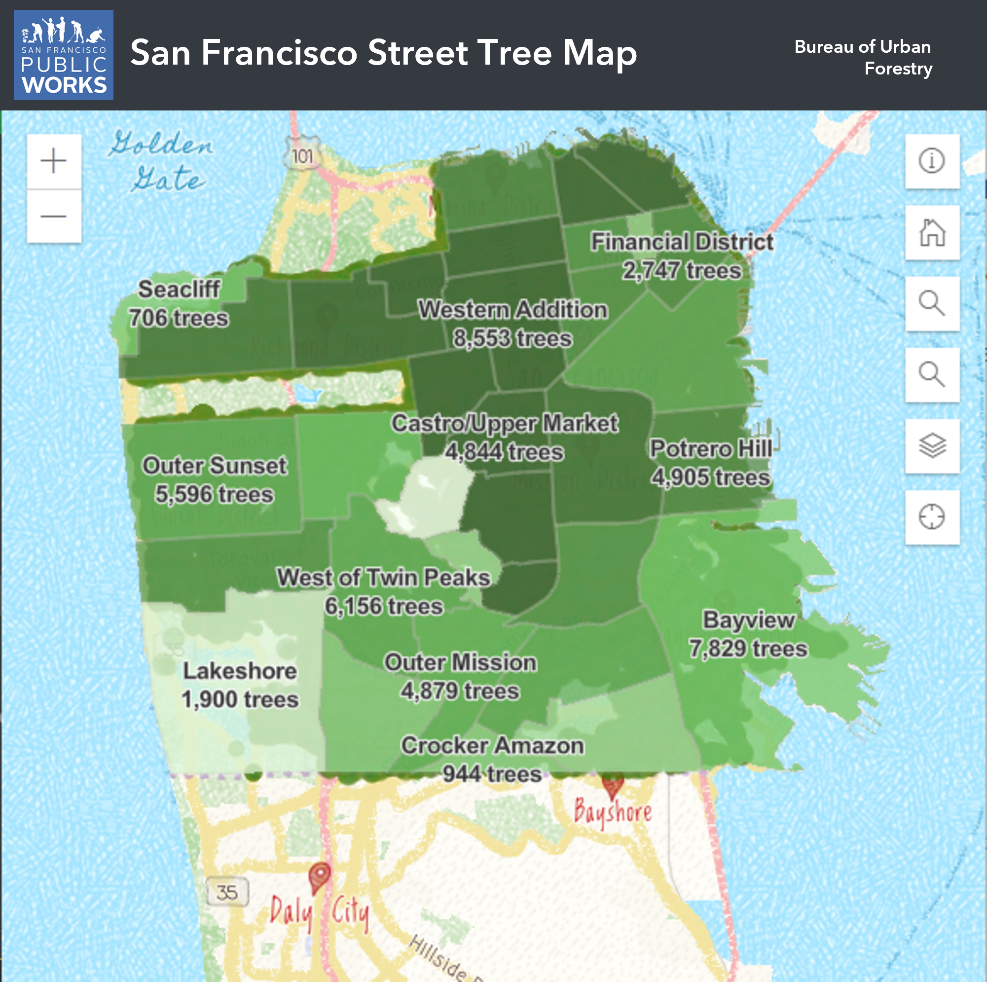
bsm.sfdpw.org/urbanforestry/
The Street Tree Map is an online database and map of San Francisco’s street trees containing information about location, species, pruning schedule and more.