 Joy DiFranza
 San Francisco Street Tree Map
bsm.sfdpw.org/urbanforestry/
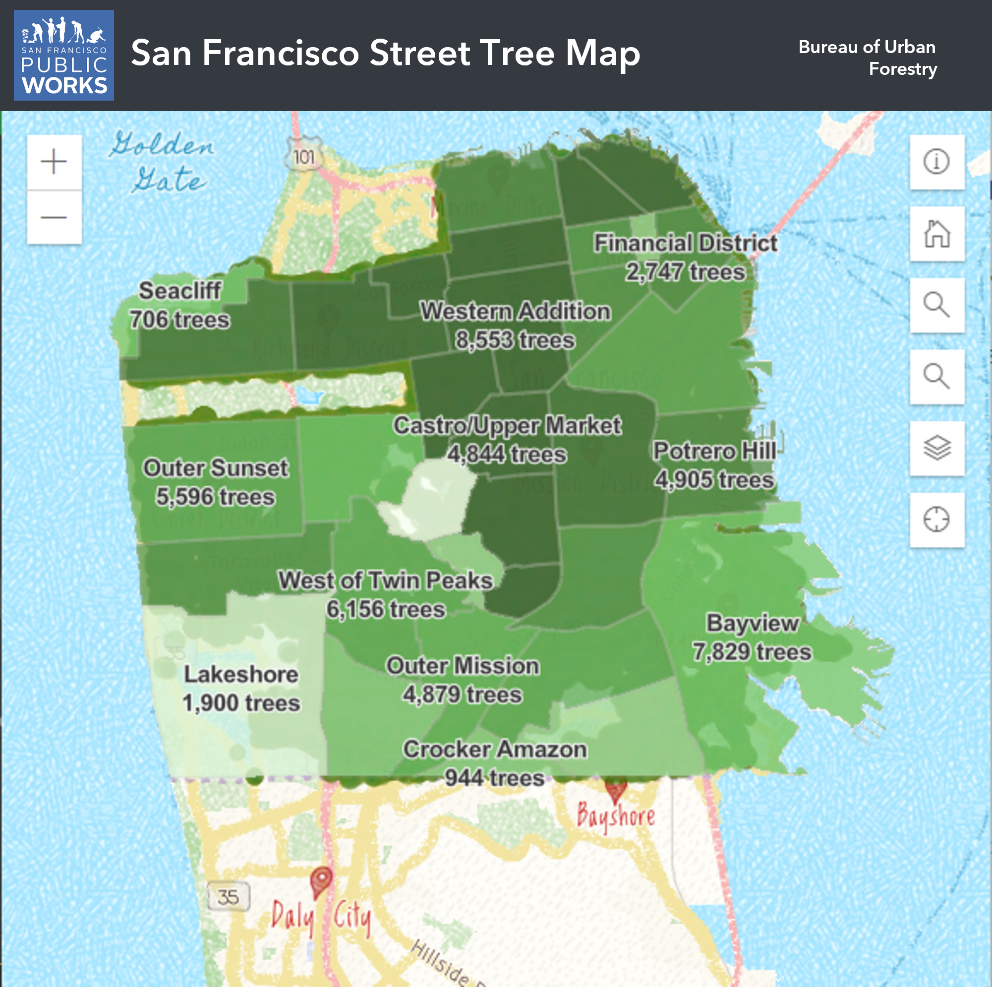
San Francisco Public Works’ Bureau of Urban Forestry maintains and cares for all of San Francisco's street trees through a program called StreetTreeSF. The Street Tree Map is an online database and map of San Francisco’s street trees. Anyone can look up information about these trees such as their location, species, pruning schedule and more. The Bureau of Urban Forestry (BUF) gathers and maintains a database of approximately 125,000 public trees.
This map pulls data from the tree inventory database and other sources and joins the data together using FME to transform the data into the tree point layer, neighborhood layer, supervisorial layer and tree pruning schedule layer to display on the map.
Platform
- Microsoft IIS web server
Website
- HTML 5
- JavaScript
- ArcGIS JavaScript API
Data
- FME
- MS SQL Server
- ArcGIS Online