 Joy DiFranza
 Fire Alert Map
firealertmap.com
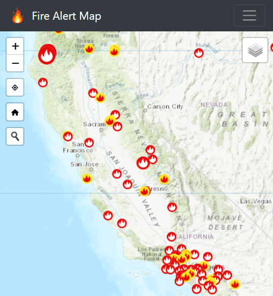
A map showing active wildfire locations, red flag warnings, fire weather watch, severe fire danger index overlay and jurisdictional boundaries.
The purpose of firealertmap.com is to gather data from various sources to provide a map showing current fire conditions and related environmental information to aid users in gaining an understanding of the current environmental conditions to support vegetation management and wildfire prevention and suppression.
With help from vegetation management and utility tree industry professionals, I put together this website to provide this data needed to carry out their work safely in the field especially in high fire danger areas.
The website is formatted for use in the field (mobile) and the office (desktop) and it has the capability to be downloaded to PDF for offline reference for 3 specific areas in California.
Platform
- Linux Ubuntu OS
- Nginx (website) web server
Website
- HTML 5
- JavaScript / Leaflet / Bootstrap / jQuery
Data
- ArcGIS Online
Repos
Map Sources
| Layer | Source |
|---|---|
|
ESRI |
|
Wildland Fire Assessment System (WFAS) |
|
US Census Bureau |
|
USDA / USFS |
|
CalFire |
|
NOAA / NWS |
|
NPS |